To find out whether a specific address falls within the Linnton boundaries go to PortlandMaps.com
The Linnton Neighborhood is located on the northern edge of Portland, on the West side of the Willamette River. Linnton is officially recognized by the City of Portland as a neighborhood and is an active participant in the Neighbors West/Northwest coalition of neighborhoods.
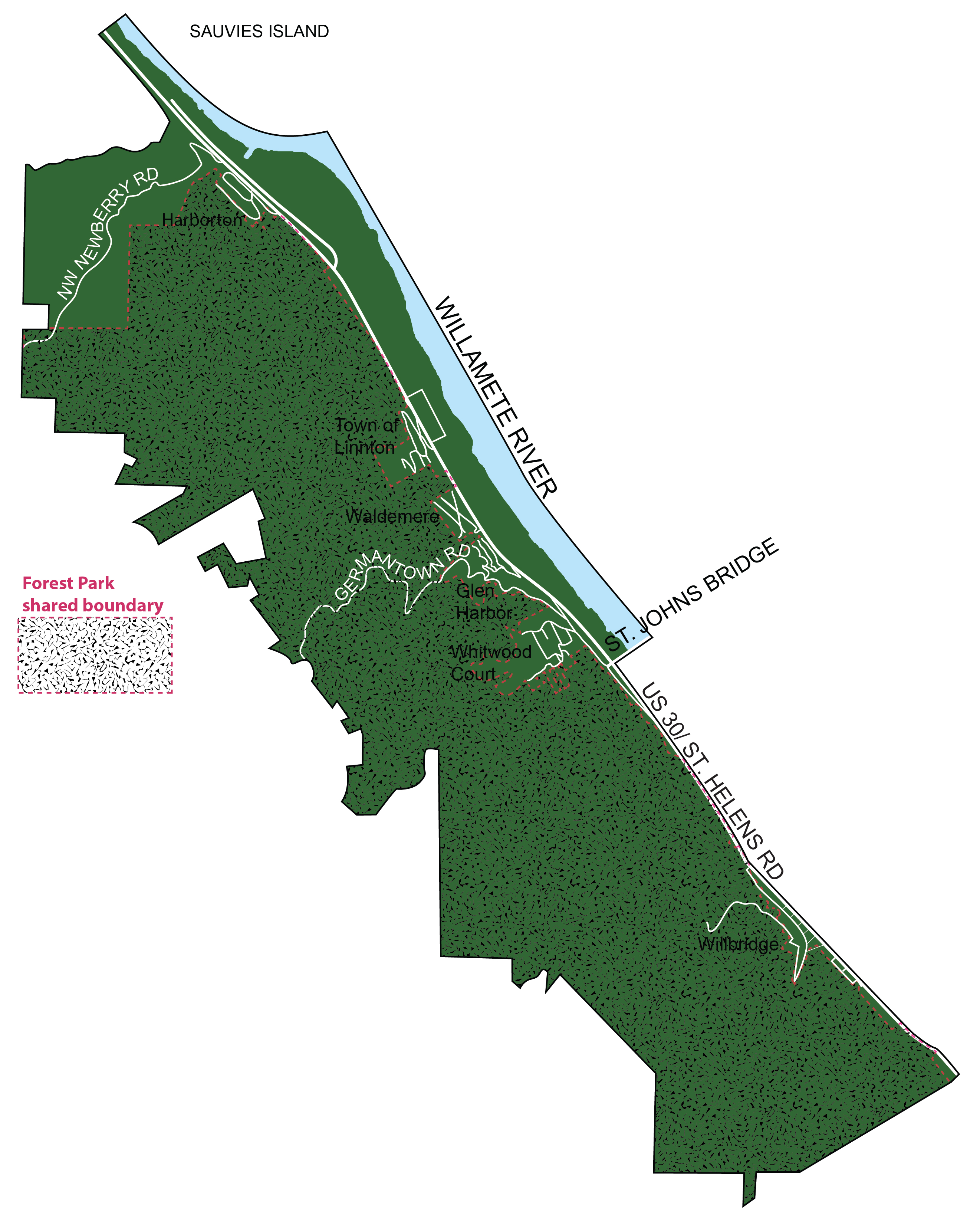
The developed part of the neighborhood is long, five and a quarter miles, and narrow, roughly a mile wide. The neighborhood is physically constrained by the Tualatin Hills and Forest Park on the West and the Willamette River on the East. The Northern boundary is the Sauvie Island Bridge.
Linnton is a community of small sub areas, six residential, three commercial, and one long industrial area located between St Helens Rd and the Willamette River. Five of the six residential areas occupy physically constrained locations on the east slope of the Tualatin Hills. These residential areas are constrained by St Helens Rd on the east, Forest Park in the West, and steep, wooded draws with creeks on their North and South sides. The exception to this situation is the Willbridge area. The main residential area of Willbridge is located at the base of the Tualatin Hills in a small slopping area that is severely constrained by the Hills and St Helens Rd.
The commercial areas are located at Willbridge, Linnton, and along the West shore of the Willamette River at the northern edge of the neighborhood. The Willbridge and Linnton commercial areas have been severely impacted by the widening of St Helens Rd and have, over the years lost many businesses and much of their vitality. The river front commercial uses are located along Marina Way, east of St Helens Rd, and are all small boat marinas.